|
I am going in circles here and wondering if anyone can help.
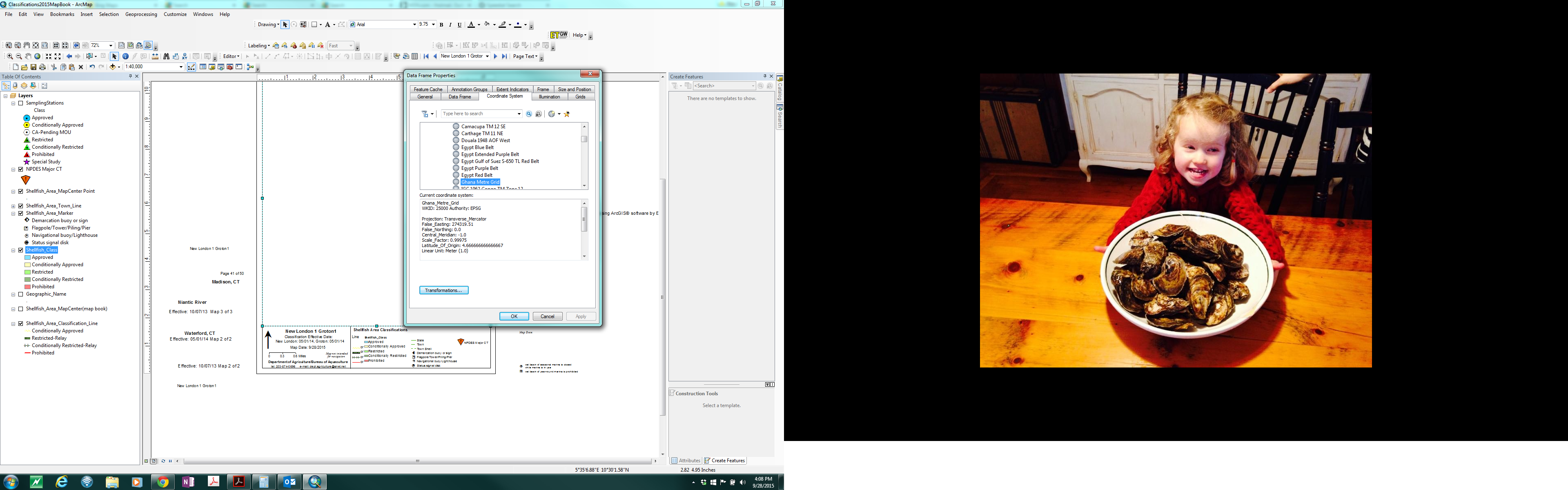
I had a perfectly functional mxd that I had enabled data driven pages in. It had been working fine for several years with no issues. All of a sudden, For some unknown reason, the coordinate system keeps changing to Ghana Metre Grid which I assure you I have never chosen.
All of my layers are in NAD_1983_2011_StatePlane_Connecticut_FIPS_0600_Ft_US, and no matter how many times I change the coordinate system data frame property back to that, when I try to export the map pdfs as a group, it switches back to Ghana and "SOME" of my maps print out blank with no geographic info. I have tried removing background maps that I typically use from ArcGIS Online. It is usually not the same maps that print out with no geographic info, I think because at some unknown point it is switching to Ghana.
When I scroll through the pages individually they look ok for awhile, but even then while I am scrolling through they are switching back to Ghana.
Any ideas?
[cid:780dd457-62e4-4c2e-b81d-5bbe9f860c28]
Kristin DeRosia-Banick
Environmental Analyst III
State of Connecticut Department of Agriculture
Bureau of Aquaculture
Office: 203.874.0696 ext 112
Cell: 203.209.4023
Fax: 203.783.9976
Email: [log in to unmask]
www.ctgrown.gov/Aquaculture
-------------------------------------------------------------------------
This list (CTGIS-L) is an unmoderated discussion list for all CT GIS
Users.
If you no longer wish to receive e-mail from this list, you can remove
yourself by going to http://listserv.uconn.edu/ctgis-l.html
|


